
Remote Sensing as a mitigation tool
Submitted by Christine on
Source:
http://ipler.cis.rit.edu/flood
Image:

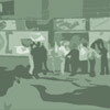
Remote Sensing can be used in various ways to develop emergency plans as well as mitigation plans before a disaster happens.
Visualizing sustainable solutions
to global and local problems
so society makes
informed choices quicker
Remote Sensing can be used in various ways to develop emergency plans as well as mitigation plans before a disaster happens.