Global

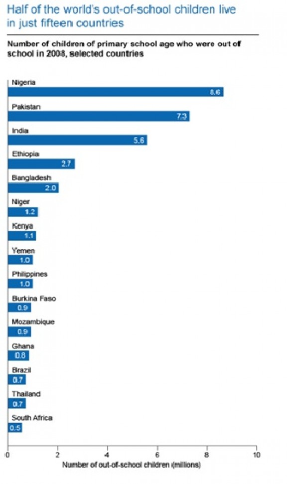
Half of Out of School Children in 15 Countries

Source: 

UNESCO Education For All Global Monitoring Report 2011

Image: 

Half of Out of School Children in 15 Countries

Shows the 15 countries with the most children not attending school in the world, which happen to contain half of the world's out-of-school children. Notice that all are impoverished nations.

Level: 

Image Type: 

Category: 

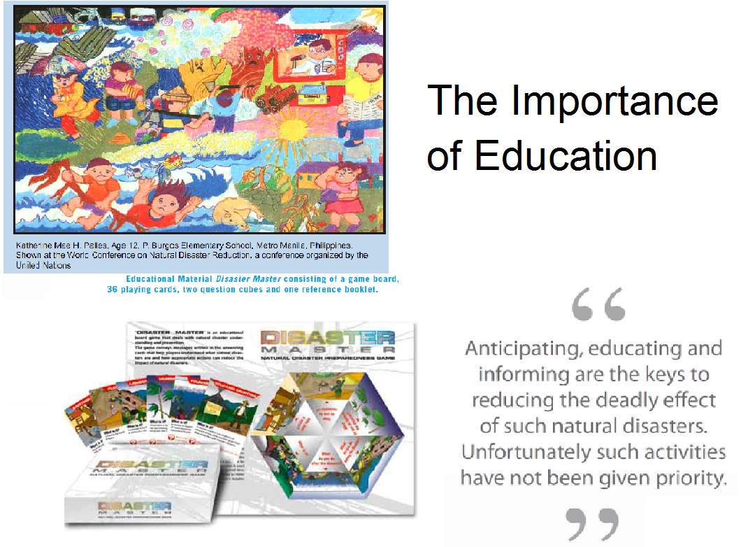
The Importance of Education

Source: 

http://unesdoc.unesco.org/images/0015/001504/150454e.pdf

Image: 

The Importance of Education

The image shows the importance of sharing the knowledge about natural disasters as well as the knowledge about the recent technologies on how to prevent and mitigate such disasters.

Level: 

Image Type: 

Category: 

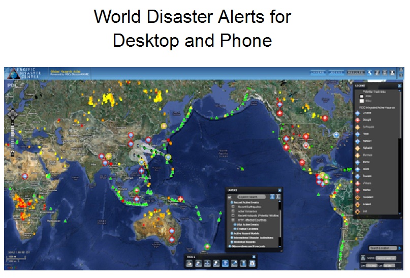
World Disaster Alerts for Desktop and Phone

Source: 

http://www.pdc.org/iweb/pdchome.html;jsessionid=0BDBEBB5A8E01B9ACF192F792E38F14D

Image: 

World Disaster Alerts for Desktop and Phone

This image shows an example of a Disaster Alert with historical as well as real time data. It is possible to receive an update as soon as there is a warning for a disaster.

Level: 

Image Type: 

Category: 

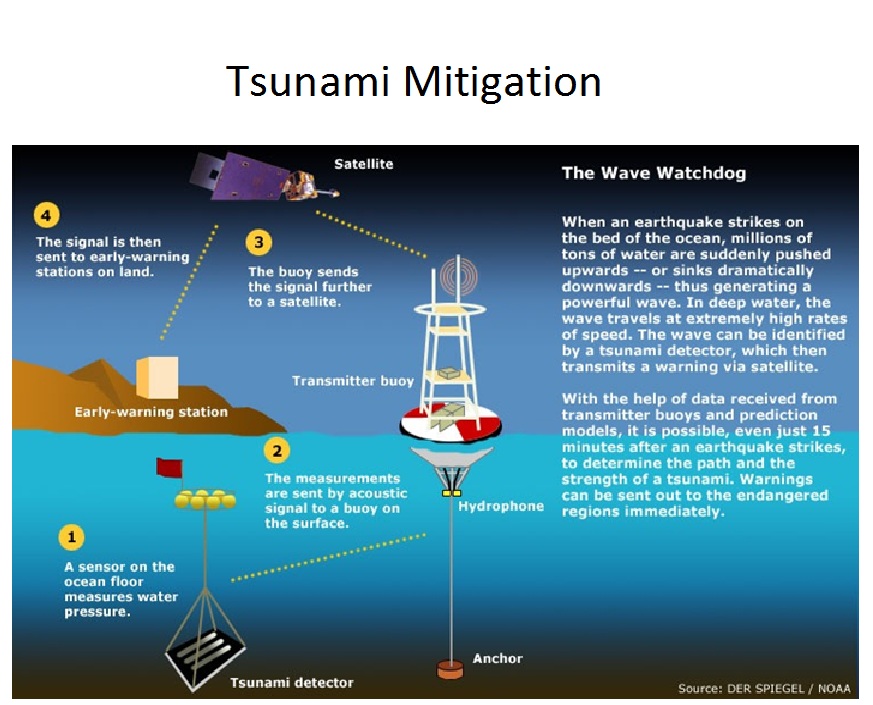
Tsunami Mitigation - The Wave Watchdog

Source: 

http://techocular.wordpress.com/2011/03/11/tsunami-early-warning-system/

Image: 

Tsunami Mitigation - The Wave Watchdog

On the image, you can see, how a tsunami warning system works. It shows the Wave Watchdog, which can send signals to a land station in order to warn a community.

Level: 

Image Type: 

Category: 

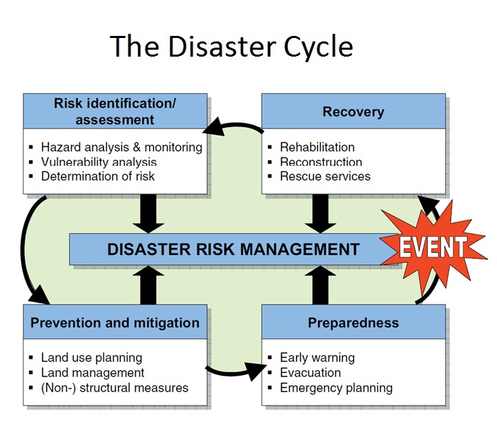
Disaster Cycle

Source: 

http://www.fig.net/pub/figpub/pub38/pub38_screen.pdf

Image: 

Disaster Cycle

The Disaster Cycle shows the steps which have to be taken after an event happened. It shows as well which steps have to be taken to be prepared for the next event.

Level: 

Image Type: 

Category: 

World health care infrastructure

Source: 

http://www.google.com/imgres?imgurl=http://www.fas.org/irp/threat/752049.gif&imgrefurl=http://www.fas.org/irp/threat/nie99-17d.htm&h=920&w=1425&sz=222&tbnid=u9q4Ifz6ssFMwM&tbnh=180&tbnw=280&zoom=1&usg=__EUJhO2E7sgZsuw21CgNmNmYeRJ0=&hl=fr&sa=X&ei=XswaULHqF-H6igKCoICYAQ&ved=0CF8Q8g0

Image: 

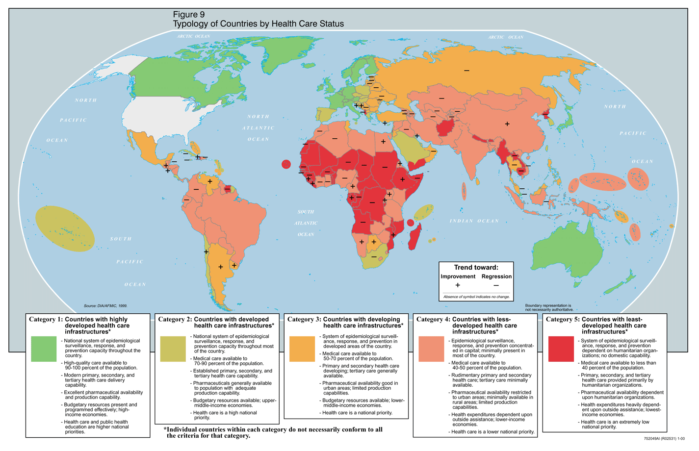
World health care infrastructure

This map is showing the global health care infrastructure

Level: 

Image Type: 

Category: 

Integrated Crisis Warning System

Source: 

http://www.wired.com/dangerroom/2007/11/lockheed-peers/

Image: 

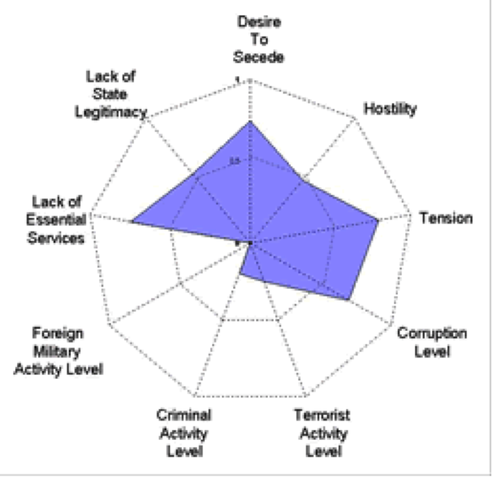
Integrated Crisis Warning System

ICEWS designed to collect and organize relevant data and information to try to predict levels of violence.

Level: 

Image Type: 

Category: 

Pages